Coordinates 53° 37'20.00"N, 56° 39'06.62"E
Category: complex (geomorphological and botanical) natural monument. Formed by the decree of the Council of Ministers of the Bashkir Autonomous Soviet Socialist Republic dated December 26, 1985 No. 212 “On the protection of wild plant species in the territory of the Bashkir Autonomous Soviet Socialist Republic”. We offer to make an addition to the category of monument – a complex geological, geomorphological and botanical natural monument.
We offer to make an addition to the category of monument – a complex geological, geomorphological and botanical natural monument.
Location: southeast from Makarovo Village, Ishimbay district, Republic of Bashkortostan.
Geomorphological characteristics
Picturesque narrow rocky ridge in the bend of the Sikasya River about 3 km long (Maps 1-3, Fig. 1). The absolute height is about 420 m above sea level, relative height to the river level – 220 m. The wall-shaped Kalim-Uskan Riverside Cliff with a Cave of Salavat is located in the southeastern part of the Kyzyltash Urochizhe (Fig. 4). The ridge as a landform was formed as a result of the denudation-erosional and slope processes activity and general uplift of the territory’.
The thalweg height of the Sikasya River is 197.7 m above sea level; the width of the riverbed at low water is approx. 10 m, the ford depth is up to 0.5 m, the flow velocity is 0.4 m / s, the bottom is rocky, silting along the riverbanks. The Sikasya River valley is V-shaped in the upstream and along the eastern slope of the Kyzyltash Urochizhe and slightly expanding along its western slope, where a small intermountain depression was formed. Sikasya is a typical example of a karst river disappearing into a sink hole at the northeastern slope of the Kyzyltash Urochizhe and reaching the surface at its southeastern slope, at a distance of about 5 km, a dry river bed can be observed at low water (Fig. 6). Sikasya River is the right tributary of the Zigan River and belongs to the Volga hydrographic basin. The Total length of the river is 46 km.
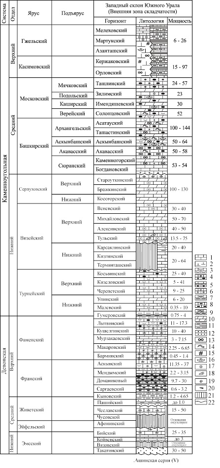
Geological characteristics
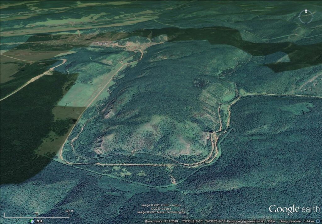
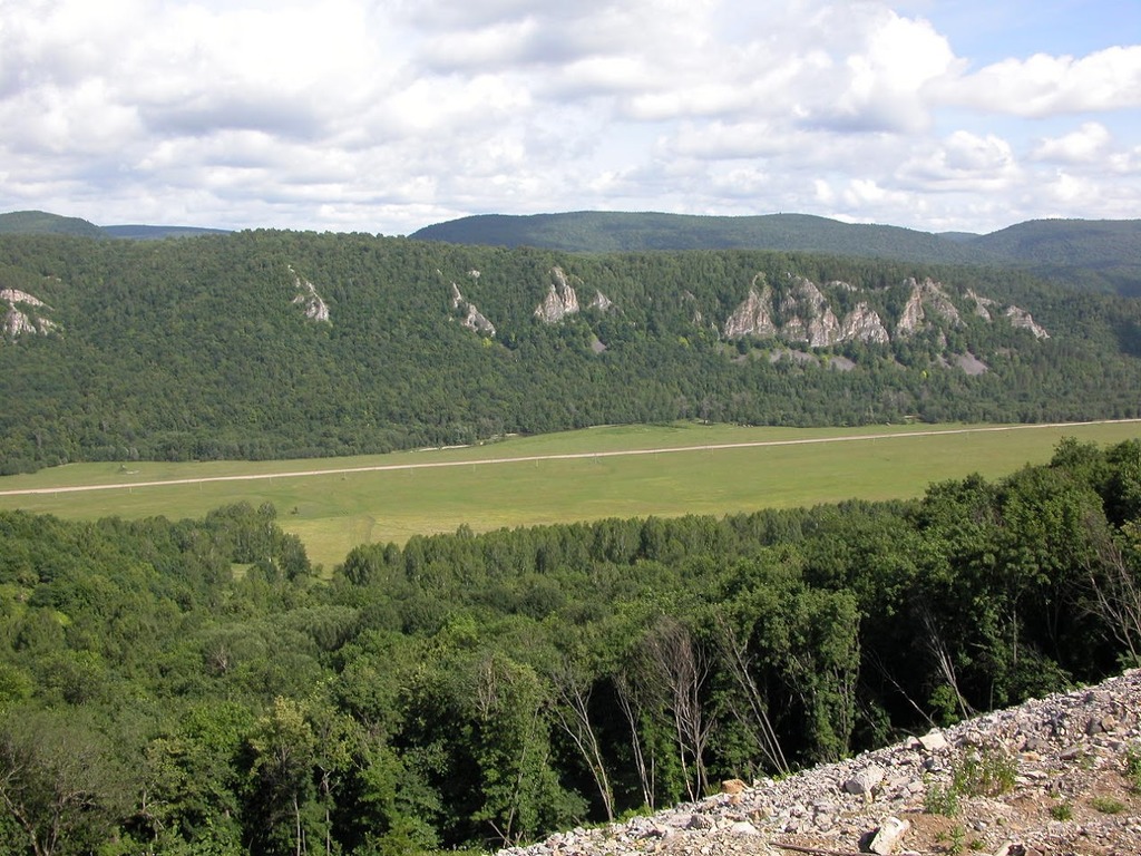
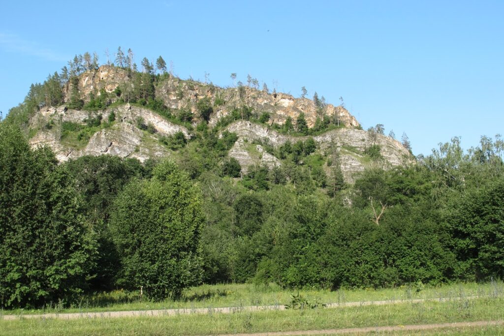
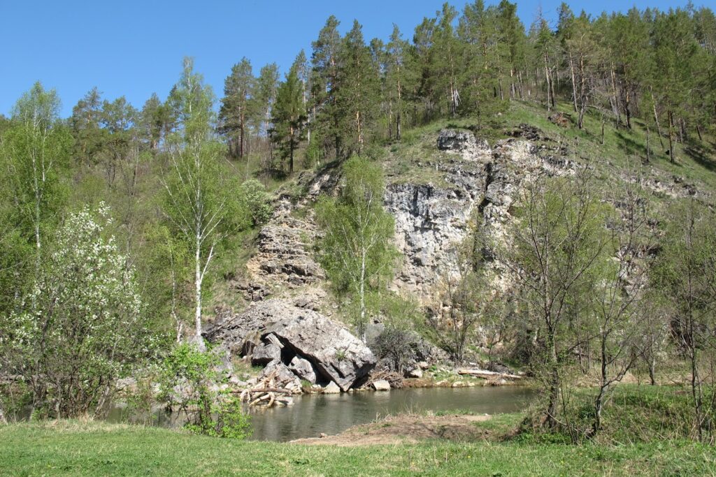
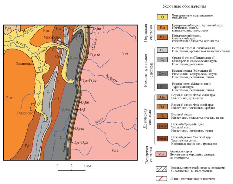
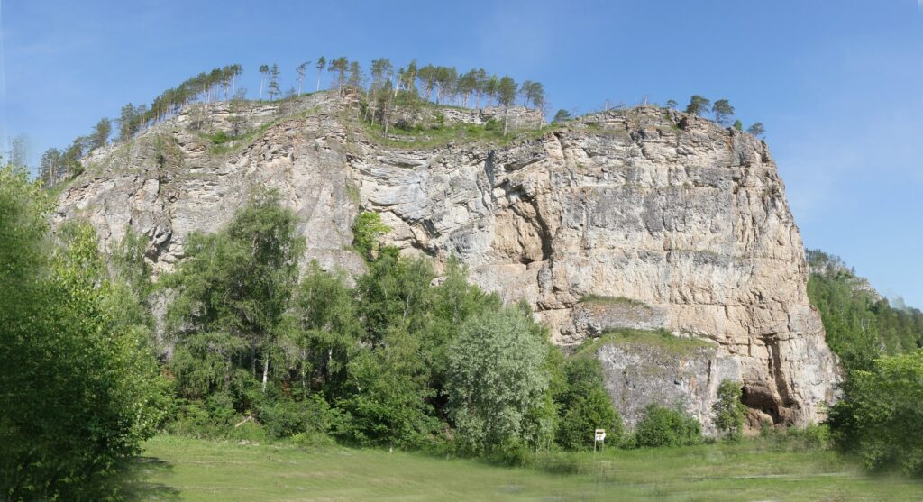
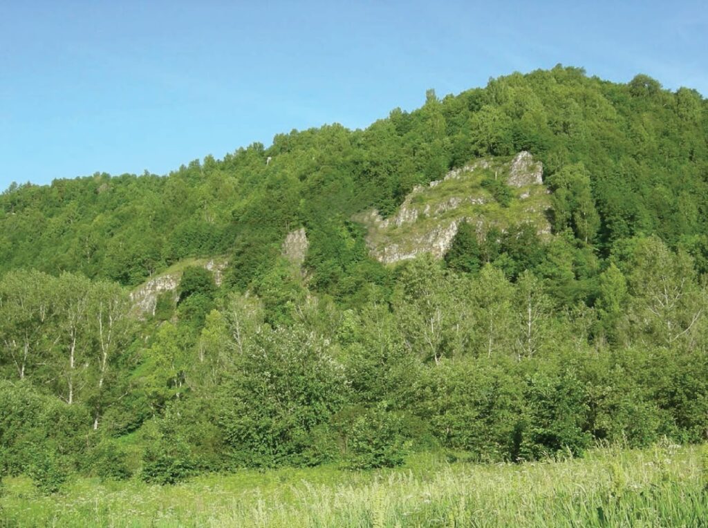
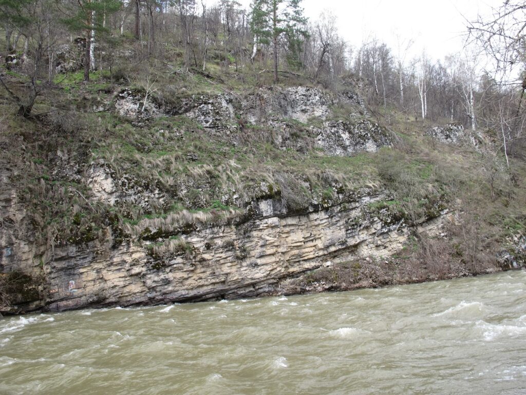
The ridge is composed of Devonian and Carboniferous mainly carbonate rocks (Map 4, Figs 1-5, 7).
The rocks form a synclinal structure complicated by tectonic disturbance from the west. This structure is well readable on the geological map. On the eastern wing of the syncline the rocks fall to the west, on the western wing of the syncline the rocks fall to the east. The angle of incidence on the eastern wing is gentler (up to 25 degrees) and steeper on the western wing (up to 40 degrees). The dolomites of the Serpukhovian Stage, composing the core of the structure, have an almost horizontal occurrence. The thickness of the Devonian deposits is about 30 m, of the Lower Carboniferous – more than 300 m.
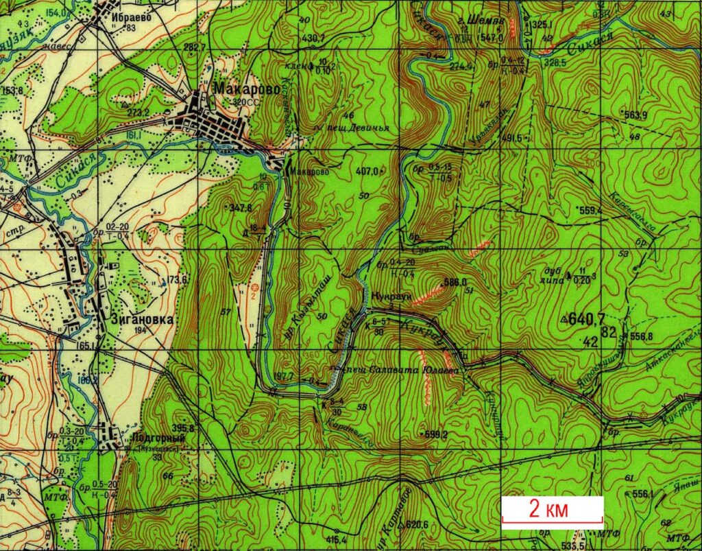
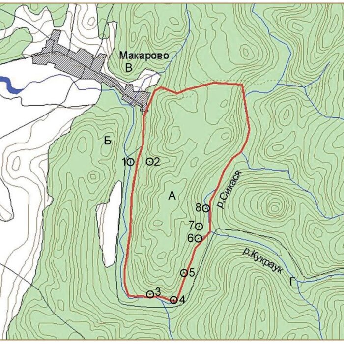
On the right bank the Sikasya River starting from the mouth of the Kukrauk River downstream there are several outcrops of the carbonate rocks of the Devonian (Upper Frasnian and Famennian) and Lower Carboniferous (Maps 2, 4, Figs 1-5). The section of the Upper Devonian deposits was described opposite the mouth of the Kukrauk River; Sikaza section is located 400 m downstream from the mouth of Kukrauk River. The Kalim-Uskan Riverside Cliff is located 800 m downstream from the Sikaza section
Fossil remains are algae, foraminifera, ostracods, corals, brachiopods, crinoids, conodonts.
Botanical characteristics
The rocks, composed of gray limestones, are covered with scaled lichens of red color; therefore, the object is called “Kyzyltash” (from the Bashkir “Red Stone”). Mixed broad-leaved forests are typical for the western slope of the Southern Urals. Oak, birch, elm, maple, aspen are mixed with the dominant linden. Pines are common on the rocks. There are small areas of rocky steppes. Rare species of plants are found: Elytrigia reflexiaristata (Nevski) Nevski, Schivereckia hyperborea (L.) Berkutenko and Astragalus clerceanus Iljin et Krasch. (Figs 8 and 9).
The natural monument has a scientific, environmental and aesthetic value.
The protection regime is established by the Regulation on natural monuments in the Bashkortostan Republic, approved by Decree of the Cabinet of Ministers of the Bashkortostan Republic dated February 26, 1999, No. 48. Due to the nature of the natural complex on the monument’s territory, the extra f building stone, grazing of cattle, any construction, collection of useful plants, any cuttings, except for selective sanitary.
G.A. Danukalova, E.I. Kulagina, E.M. Osipova.